> For the complete documentation index, see [llms.txt](https://help.felt.com/llms.txt). Markdown versions of documentation pages are available by appending `.md` to page URLs; this page is available as [Markdown](https://help.felt.com/data-sources/global-library.md).
# Global Library
Felt's curated global catalog. Regional boundaries, demographics, imagery, and more. Available to every workspace at no storage cost.
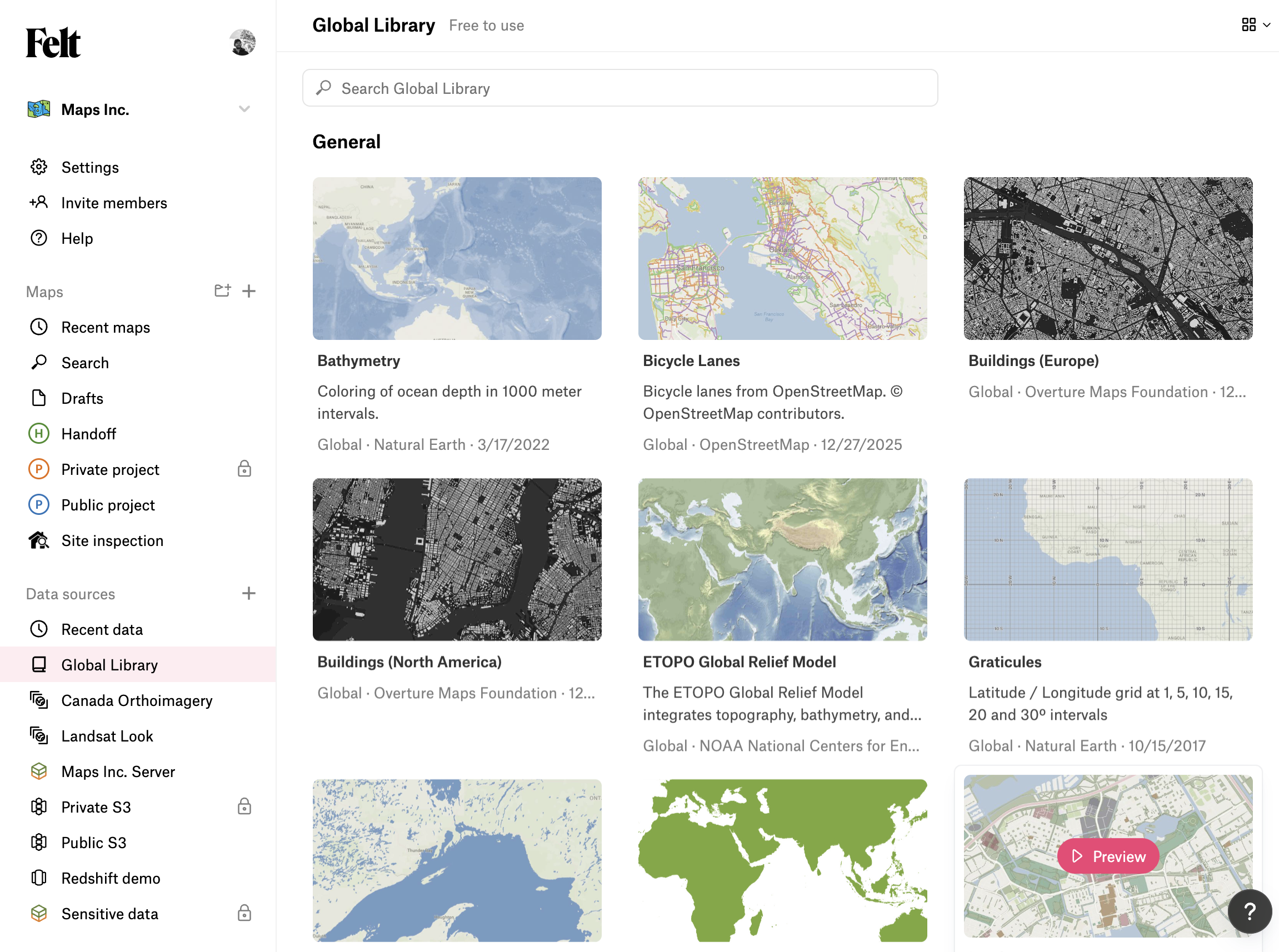
The **Global Library** is a data source that every Felt workspace has access to, pre-populated with a catalog of curated datasets maintained by Felt. It's the same collection of layers you'll find at [felt.com/explore](https://felt.com/explore), exposed directly in your workspace alongside your own data sources.
## What's in it
The Global Library is organized by topic, with coverage that spans:
* **Administrative boundaries** — countries, states and provinces, counties, municipalities, neighborhoods, census geographies.
* **Demographics** — population, housing, and economic indicators at common census geographies.
* **Environment and land cover** — elevation, land cover, hydrology, protected areas.
* **Imagery and basemaps** — aerial imagery, satellite mosaics, reference basemaps.
* **Transportation and infrastructure** — roads, transit, points of interest.
## Adding a Global Library layer to a map
1. Open the in-map library with  or open the Global Library tab from the workspace homepage.
2. Browse by topic or search within the Global Library.
3. Click a layer to preview it.
4. From the preview panel, click **Add to map**.
A **copy** of the layer is placed on your map. You can restyle, filter, or edit it freely — changes don't flow back to the catalog.
## Attribution
Many Global Library datasets come from third parties and carry their own attribution requirements. See the [attribution policy](/terms-and-policy/attribution-policy.md) for details.
---
# Agent Instructions
This documentation is published with GitBook. GitBook is the documentation platform designed so that both humans and AI agents can read, navigate, and reason over technical content effectively. Learn more at gitbook.com.
## Querying This Documentation
If you need additional information that is not directly available in this page, you can query the documentation dynamically by asking a question.
Perform an HTTP GET request on the current page URL with the `ask` query parameter, and the optional `goal` query parameter:
```
GET https://help.felt.com/data-sources/global-library.md?ask=&goal=
```
`ask` is the immediate question: it should be specific, self-contained, and written in natural language.
`goal` is optional and describes the broader end goal you are ultimately trying to accomplish on behalf of the user. GitBook uses it to tailor the answer towards what is most useful for that goal.
The response will contain a direct answer to the question and relevant excerpts and sources from the documentation.
Use this mechanism when the answer is not explicitly present in the current page, you need clarification or additional context, or you want to retrieve related documentation sections.